The “Finger of Land” Into Arlington: Fort Worth’s Strategic Reach
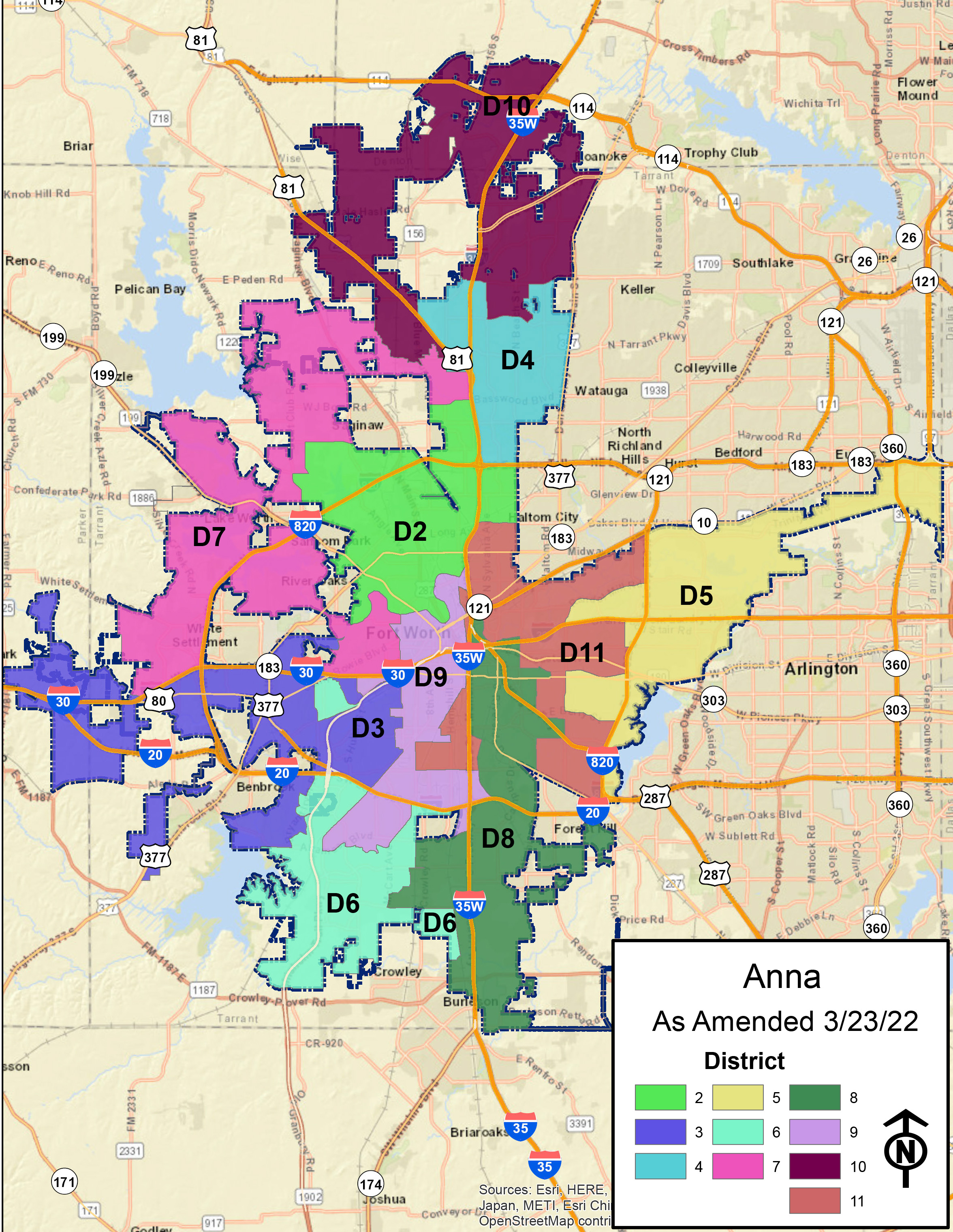

If you’ve ever looked closely at a city map of North Texas, you might notice something unusual: a narrow stretch of Fort Worth territory reaching eastward into what is otherwise Arlington and the Mid-Cities.
At first glance, it looks like a mapping error—or a leftover quirk of development.
But in reality, this “finger of land” is one of the most intentional geographic moves in Texas history.
A Corridor by Design, Not Accident
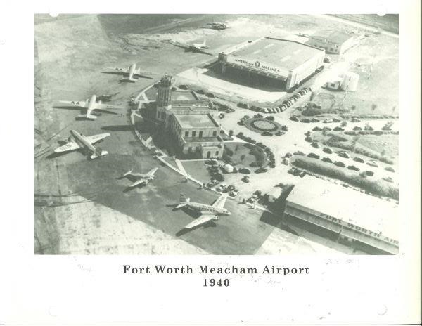
The strip dates back to the mid-20th century, when Fort Worth was determined to secure its place in the rapidly growing aviation industry.
At the center of this story is Amon G. Carter Sr.—a powerful newspaper publisher, businessman, and one of the city’s most influential boosters.
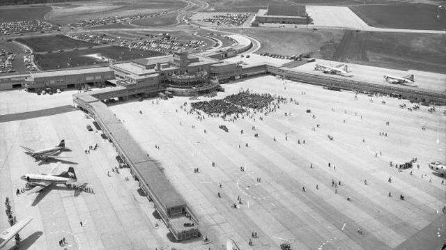
When Fort Worth developed what became Greater Southwest International Airport (originally called Amon Carter Field), the city made a bold move:
👉 It annexed a narrow strip of land stretching eastward from Fort Worth all the way to the airport site.
This ensured the airport was officially within Fort Worth’s city limits—even though geographically, it sat closer to Arlington.
Why Go to Such Lengths?
1. Keep the Airport “In Fort Worth”
Airports were (and still are) economic powerhouses. By extending its boundaries, Fort Worth could:
- Collect tax revenue from airport operations
- Control surrounding development
- Claim the airport as its own—politically and symbolically
Without annexation, the airport might have fallen under Arlington’s jurisdiction.
2. Rivalry With Dallas
No story in North Texas is complete without mentioning Dallas.
At the time, Dallas already had Dallas Love Field, which was closer to downtown and quickly became more successful.
Amon Carter was famously anti-Dallas. His goal was clear:
👉 Fort Worth needed its own major airport, regardless of geography.
This “finger” of land helped guarantee that—even if the airport physically sat nearer to Arlington.
3. A Vision for a Regional Airport

Interestingly, the airport’s location wasn’t random. It sat roughly between Fort Worth and Dallas—hinting at a bigger ambition:
- Fort Worth hoped Dallas would eventually share the airport
- The site was ideal for serving the entire region
- It was an early attempt at what we’d now call a “regional hub”
But Dallas resisted the idea for years, preferring to invest in its own airport instead.
What Happened Next
The plan didn’t unfold as Fort Worth hoped.
- Most travelers continued using Love Field
- Greater Southwest International Airport struggled to compete
- Passenger traffic remained relatively low
By the 1960s, the federal government stepped in and pushed both cities toward cooperation.
This ultimately led to the creation of
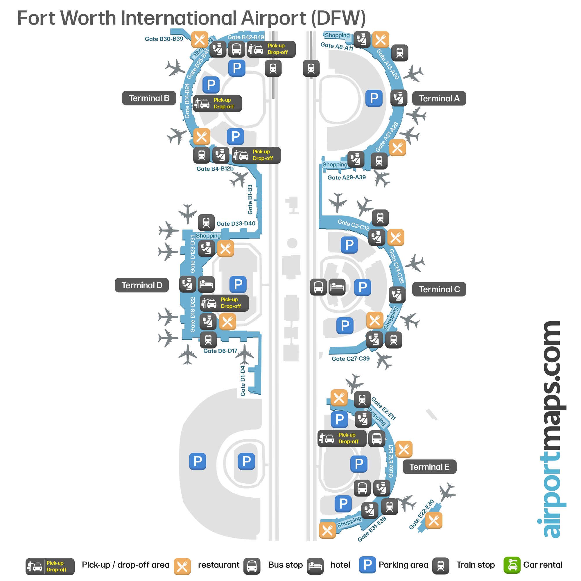
Dallas/Fort Worth International Airport—built north of the original site.
When it opened in 1974:
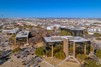
- The old airport closed
- The land was redeveloped into what we now know as CentrePort
- The region finally had a unified aviation hub
The Legacy Today
That narrow Fort Worth corridor still exists today.
✔️ It’s a real extension of Fort Worth into Arlington/Mid-Cities
✔️ It was intentionally created to control the airport
✔️ It reflects a time of intense regional rivalry and ambition
And while the airport it was built for is long gone, the “finger of land” remains—a quiet but powerful reminder of how geography can be shaped by politics, economics, and vision.
Bottom Line
The unusual Fort Worth boundary isn’t a mistake—it’s a strategic move from the 1940s–50s.
Driven by leaders like Amon G. Carter Sr., it was part of a larger effort to:
- Compete with Dallas
- Control a major economic asset
- Position Fort Worth at the center of regional growth
In the end, the airport didn’t survive—but the geography it created did.
Rick Herring
thmjmj@gmail.com